By using this site you agree to the use of cookies by the company in accordance with the Privacy Policy
Choosing the right Drone Detector is becoming a practical priority for airports, industrial sites, event venues, and critical infrastructure teams. Global buyers now compare more than detection range. They examine sensor accuracy, weather performance, installation demands, software integration, and total operating cost. A system that performs well on a clear morning may struggle beside steel structures, strong radio signals, or heavy rain. Real conditions matter.
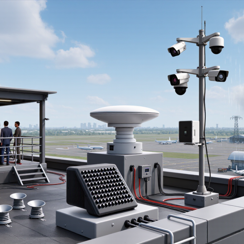
Jörg Lamprecht, founder of Dedrone, has emphasized, “You cannot protect what you cannot detect.” This principle supports a careful review of today’s main Drone Detector types. Radio-frequency detectors can identify communication signals from compatible aircraft and controllers. Radar-based systems can track movement, including some autonomous flights. Electro-optical and infrared cameras provide visual confirmation, especially during daylight or low-light operations. Acoustic sensors may help in quiet environments, although wind and machinery can reduce their value. Multisensor platforms combine these methods and often deliver stronger verification.
This guide examines the leading options for 2026. It considers realistic deployment details, such as rooftop mounting, camera blind spots, network latency, and maintenance access. It also separates marketing claims from measurable performance. That distinction is important. No detector is perfect.
Buyers should define their site risks before selecting equipment. A compact RF unit may suit a warehouse perimeter. A large airport may need layered coverage, centralized monitoring, and trained operators. Local aviation, privacy, procurement, and safety requirements must guide every deployment. Product comparisons can still be imperfect. Field testing remains essential.
Drone detection begins with understanding what each sensor can actually observe. Radio-frequency detectors listen for control links, telemetry, and identification signals. They can provide early alerts across wide areas, even before a drone becomes visible. However, autonomous flights may transmit little or no radio traffic. That limitation matters.
Radar detects movement by measuring reflected electromagnetic waves. It can estimate range, speed, altitude, and direction in darkness or light rain. Small drones remain difficult targets, especially near trees, buildings, and birds.
Electro-optical and infrared cameras add visual confirmation. They help operators inspect a tiny aircraft against a bright sky or a warm rooftop, but cameras need a clear line of sight.
Acoustic sensors analyze propeller noise. They are useful in quiet locations, yet wind, traffic, and construction can create false alarms.
A practical system often combines these methods. This is called sensor fusion. The 2024 Grand View Research analysis estimated strong growth in the global anti-drone market, reflecting wider demand for layered detection rather than one universal sensor. Fortune Business Insights also projected substantial market expansion through 2032.
These figures describe commercial momentum, not guaranteed performance. Buyers should request tested detection ranges, update rates, false-alarm data, and performance in rain, clutter, and low-light conditions.
Numbers can look impressive. Field conditions are less polite.
In my experience, the best specification is not the longest claimed range. It is a transparent test method, lawful operation, and clear evidence that the system identifies aircraft consistently.
2026 Top Drone Detector Types for Global Buyers
Drone activity is becoming a larger procurement issue. The FAA’s 2024 Aerospace Forecast reported more than 800,000 civil drones registered in the United States at the end of 2023. For global buyers, detection now requires more than one technical method. CISA’s Counter-UAS Technology Guide identifies radio frequency, radar, electro-optical, infrared, and acoustic sensing as key detection approaches.
RF detectors listen for command links and telemetry near protected areas. They can identify familiar transmission patterns quickly, but autonomous flights may reduce their value. Radar measures range, speed, and direction, even in darkness. Buildings, birds, and weather can create false tracks. Optical and infrared sensors provide visual confirmation, such as a small aircraft crossing a rooftop camera at dusk. However, fog, glare, and limited viewing angles remain practical weaknesses.
Acoustic detectors use rotor noise and may support short-range monitoring. Wind, traffic, and construction noise can easily interfere. Multi-sensor systems combine these inputs through software, improving confidence before an operator responds. A 2024 MarketsandMarkets study described the drone detection market as a double-digit-growth segment, reflecting rising demand for layered systems. Still, market forecasts are not guarantees. I would not trust a single green dashboard. Buyers should test detection accuracy, latency, maintenance needs, data protection, and local compliance in real operating conditions.
The chart compares typical planning ranges under favorable line-of-sight conditions. RF and radar systems generally provide longer-range detection, optical systems support visual verification, acoustic systems are useful at short range, and multi-sensor solutions combine complementary detection methods.
2026 Top Drone Detector Types for Global Buyers?
Key Differences in Range, Accuracy, Portability, and Coverage
Drone detectors differ sharply in range, accuracy, portability, and coverage. RF-based sensors can identify control signals from several kilometers away, but their performance drops in dense cities. Radar systems provide stronger airspace awareness and can detect autonomous aircraft, yet buildings, birds, and weather may create false alerts. Acoustic sensors are compact and inexpensive. Their useful range is usually shorter, especially beside roads or machinery.
Accuracy needs careful interpretation. “Detection rate” does not equal reliable identification. MarketsandMarkets valued the global anti-drone market at about USD 1.6 billion in 2023 and projected roughly USD 3.8 billion by 2028. That growth reflects demand for layered systems, not one perfect sensor. In practical testing, combining RF, radar, and optical verification can reduce uncertainty. It also increases installation, training, and maintenance costs.
Portable detectors suit temporary sites and small teams. Fixed radar and camera networks provide broader coverage around airports, industrial facilities, and public venues. Optical systems offer useful visual confirmation, but darkness, rain, and line-of-sight limits remain serious weaknesses. Acoustic units can work well in quiet rural areas. They struggle near generators. The European Union Aviation Safety Agency continues to emphasize risk-based drone operations and local compliance requirements. Buyers should document range under real conditions, including walls, trees, glare, and interference. No detector is perfect. That uncomfortable fact is often missed in sales comparisons.
Global buyers should match drone detectors to the security scenario, not chase the newest specification. Radio-frequency detectors work well where command signals are common, such as warehouses, campuses, and event venues. They can identify signal patterns from a distance. However, autonomous flights may reduce their usefulness.
Radar suits open areas, including airports, energy sites, and coastal facilities. It can track movement in rain, darkness, and moderate dust. Yet radar may confuse birds, vehicles, or nearby structures with small aircraft. Careful site testing remains essential. It is not a magic solution.
Optical and thermal cameras add visual confirmation. They help operators judge direction, size, and flight behavior. Thermal sensors are valuable at night, while optical cameras perform better in clear daylight. Acoustic detectors can support quieter locations, but wind, traffic, and machinery may create false alerts.
A mixed system often fits complex sites. For example, an industrial facility may use RF detection near buildings, radar across open ground, and cameras for verification. Buyers should request trial data from similar environments. Ask about detection range, alert delay, weather performance, maintenance, and data protection.
Local aviation rules and privacy requirements must guide deployment. Detection alone does not justify unsafe action. Some specifications look impressive on paper. Real conditions can be less cooperative. This is where many purchasing plans need honest review. Secure logs, trained operators, and regular testing often matter as much as sensor type.
2026 Top Drone Detector Types for Global Buyers
Choosing a drone detector is not only a technical decision. International compliance can shape the entire purchasing process. RF detection systems identify communication signals, while radar-based units track movement and distance. Optical and acoustic sensors can add visual or sound confirmation. In my experience, layered systems perform better near airports, factories, and public venues. However, no detector works perfectly in every environment. Buildings, weather, and nearby radio equipment may create false alerts.
Integration deserves equal attention. Ask whether the detector supports secure APIs, standard network protocols, and accurate time synchronization. Alarm data should connect with approved security platforms, cameras, and access controls. Check local spectrum rules before selecting any active transmission feature. Privacy requirements may also affect camera placement and data storage. Buyers should request compliance documents, testing reports, maintenance procedures, and operator training materials. A low purchase price can become expensive when calibration and technical support are unclear.
Tips: Define the protected area with a site survey. Compare detection range, response time, weather resistance, and false-alarm rates. Confirm local aviation, radio, privacy, and import requirements with qualified authorities. Test the system during day and night conditions. Keep written records of approvals, software updates, and maintenance. One detail is often missed: staff need clear escalation procedures. Technology alone cannot replace trained judgment.
Comparative reference table for selecting non-kinetic drone detection technologies across international operating environments.
| Detector Type | Primary Sensing Principle | Typical Detectable Evidence | Typical Effective Range* | Main Strengths | Main Limitations | Integration Requirements | International Compliance Considerations | Best-Fit Purchasing Scenarios |
|---|---|---|---|---|---|---|---|---|
| RF Spectrum Detection | Passive monitoring of radio-frequency emissions and signal characteristics. | Control links, telemetry, video links, remote-identification transmissions, and other drone-related RF activity. | Approximately 1–5 km in open conditions; heavily dependent on transmitter power, antenna height, spectrum congestion, and terrain. | Fast alerts, passive operation, useful classification data, and relatively low installation complexity. | May miss autonomous, pre-programmed, frequency-hopping, encrypted, or very low-power systems; urban interference can reduce performance. | Ethernet or secure wireless network, time synchronization, spectrum database, alarm management, and optional camera or radar cueing. | The receiver is generally passive, but intentional transmission or interference functions require separate national authorization. Confirm radio-emission, cybersecurity, and data-protection requirements. | Prisons, airports, industrial sites, public venues, and temporary security deployments where rapid RF awareness is required. |
| RF Direction Finding | Comparison of signal arrival time, phase, or amplitude across multiple antennas. | Bearing or directional line toward an RF-emitting controller, aircraft, or relay. | Approximately 1–10 km for suitable RF sources; localization accuracy varies with antenna layout and multipath conditions. | Adds direction and potential geolocation to basic RF detection; supports multi-site triangulation. | Reflections, blocked line of sight, moving emitters, and insufficient sensor spacing can create bearing errors. | Accurate sensor coordinates, common time reference, geospatial mapping, multi-sensor networking, and optional electro-optical verification. | Check spectrum-monitoring permissions, lawful interception restrictions, radio equipment conformity, and cross-border transfer rules for location data. | Large campuses, border areas, critical infrastructure, and sites requiring probable operator-location assessment. |
| Remote-ID and Protocol-Aware Detection | Reception and interpretation of standardized or manufacturer-specific broadcast identification messages. | Aircraft identification data, position, altitude, speed, heading, and sometimes take-off or operator-related information, when legally broadcast and available. | Often a few hundred metres to several kilometres, depending on the broadcast technology, receiver location, antenna, and obstructions. | Low-cost situational awareness, useful compliance monitoring, and direct data for map-based tracking. | Does not reliably detect non-compliant, modified, silent, or unsupported aircraft; message availability differs by jurisdiction and airspace category. | Bluetooth or Wi-Fi reception, protocol updates, mapping software, secure data storage, and integration with airspace-management systems. | Verify which Remote-ID rules apply in the target country or region. Handle operator, location, and aircraft data according to privacy and retention laws. | Airports, urban authorities, event operators, and compliance teams monitoring authorized drone activity. |
| X-Band or Ku-Band Radar | Active transmission and analysis of reflected radio waves to estimate range, bearing, elevation, and motion. | Physical airborne targets, track position, velocity, and movement pattern, including some RF-silent drones. | Approximately 1–8 km for compact systems; larger or higher-performance systems may cover more, subject to target size and environment. | Works against radio-silent targets and provides continuous tracks in day, night, and many weather conditions. | Small drones have low radar cross-sections; birds, buildings, vegetation, ground clutter, and weather can produce false alarms. | Network connectivity, clutter maps, track management, maintenance access, optional EO/IR confirmation, and electromagnetic compatibility planning. | Active radar operation may require spectrum authorization, type approval, site licensing, and electromagnetic-exposure assessment. Review export-control classification where applicable. | Critical infrastructure, coastal facilities, large compounds, and locations needing detection independent of drone transmissions. |
| Electro-Optical and Infrared Imaging | Visible-light cameras, thermal imaging, or combined optical and infrared observation. | Visual or thermal signature, airframe shape, lights, payload outline, and confirmation of a radar or RF track. | Typically several hundred metres to approximately 3 km for small drones, depending on lens, atmospheric clarity, lighting, and target size. | Strongest method for human-verifiable identification and evidence recording; useful for classification and incident review. | Performance declines in darkness, fog, rain, haze, glare, and occluded views; optical systems normally require cueing. | Precision pan-tilt control, geospatial calibration, visible/thermal analytics, event recording, and radar or RF cueing. | Consider privacy, surveillance, biometric-data, video-retention, and data-localization laws. Confirm camera equipment conformity and cybersecurity controls. | Evidence-based security operations, airports, correctional facilities, public events, and sites with good lines of sight. |
| Acoustic Detection | Detection and classification of characteristic propeller and motor sound patterns using microphone arrays. | Acoustic signatures associated with multirotor or fixed-wing propulsion. | Usually hundreds of metres; range is strongly affected by wind, rain, traffic, machinery, buildings, and drone speed. | Passive, comparatively inexpensive, and useful where RF emissions are absent or difficult to interpret. | Shorter range and higher false-alarm risk in noisy environments; limited altitude and localization performance. | Microphone-array placement, environmental-noise training, edge processing, weather protection, and optional RF or camera confirmation. | Generally passive, but recorded audio may create privacy and data-retention obligations. Verify outdoor equipment, electrical safety, and environmental ratings. | Quiet rural sites, campuses, temporary deployments, and cost-sensitive installations used as an additional detection layer. |
| Multisensor Fusion Platform | Correlation of radar, RF, Remote-ID, optical, infrared, acoustic, and external airspace data into a unified track. | Combined track identity, confidence score, movement history, probable classification, and sensor-specific evidence. | Determined by the longest useful sensor range and the quality of sensor placement; coverage can be expanded through networked sites. | Improves confidence, reduces single-sensor blind spots, supports command-center workflows, and enables scalable site coverage. | Higher acquisition and lifecycle cost; integration errors, time drift, incompatible interfaces, and cybersecurity weaknesses can reduce value. | Documented APIs, common time synchronization, GIS, secure network architecture, role-based access, audit logs, health monitoring, and open data formats. | Assess every component separately for radio, radar, electrical, cybersecurity, privacy, export-control, and public-procurement obligations. | Airports, national infrastructure, major venues, multi-site security programs, and buyers requiring a long-term platform rather than a single sensor. |
| Passive RF + Radar Hybrid | Combines passive RF awareness with active radar tracking and optional optical confirmation. | RF-emitting activity, radio-silent physical targets, trajectory, speed, and evidence-supported classification. | Commonly approximately 2–8 km for suitable site conditions; performance is not uniform across all drone sizes or environments. | Balances passive detection and all-target tracking while improving confidence through complementary sensor data. | More expensive and operationally complex than either sensor alone; radar licensing and site engineering may be required. | Sensor-fusion software, radar site survey, RF database, secure control network, track deconfliction, and maintenance training. | Review active-emission authorization, RF receiver conformity, electromagnetic compatibility, export rules, privacy, and local security procurement requirements. | High-value sites needing broad detection coverage and better resilience against silent, autonomous, or non-compliant drones. |
Purchasing notes: Range figures are indicative planning values, not guaranteed specifications. Actual performance depends on drone size, altitude, antenna height, terrain, weather, spectrum congestion, sensor placement, and local interference.
Compliance checklist: Before purchase, confirm local radio-spectrum authorization, radar licensing, electrical and electromagnetic compatibility requirements, cybersecurity controls, privacy obligations, data-retention rules, export restrictions, import documentation, and after-sales service capability.
Operational boundary: Detection and identification are distinct from tracking, interception, jamming, or physical response. Any mitigation function requires separate legal, technical, and regulatory assessment in the destination country.
By using this site you agree to the use of cookies by the company in accordance with the Privacy Policy
Have a questions or want to know more about our company? We'll be expecting you.